Tourism
Destination North Coast growth, hospitality and visitor economy.


Our Vision
Our mandate focuses on mobilising investment, enabling enterprise development and supporting high-impact sectors including agriculture, tourism, manufacturing and services, while coordinating with district and local municipal priorities.
Building business. Empowering people. Growing iLembe.


Where We Work
iLembe lies about 65 km north of Durban on KwaZulu-Natal's east coast. It is the smallest district in the province by land area and consists of four local municipalities.
We package and promote investment-ready opportunities with partners in public and private sectors to support sustainable growth and job creation in iLembe.
Destination North Coast growth, hospitality and visitor economy.

Catalytic development linked to logistics and urban expansion.

Enterprise support across industrial and service value chains.

Food systems, agri-processing and sustainable growth initiatives.

Clean energy investment, solar and wind generation projects.

Digital infrastructure, tech innovation and connectivity solutions.
Programmes
Enterprise iLembe delivers practical support through project packaging, investment facilitation and business support programmes that improve market access, strengthen local enterprises and support inclusive participation in the district economy.

Latest
Announcements, notices and event highlights from Enterprise iLembe.
Opportunities
Review open procurement notices and submission dates published by Enterprise iLembe.
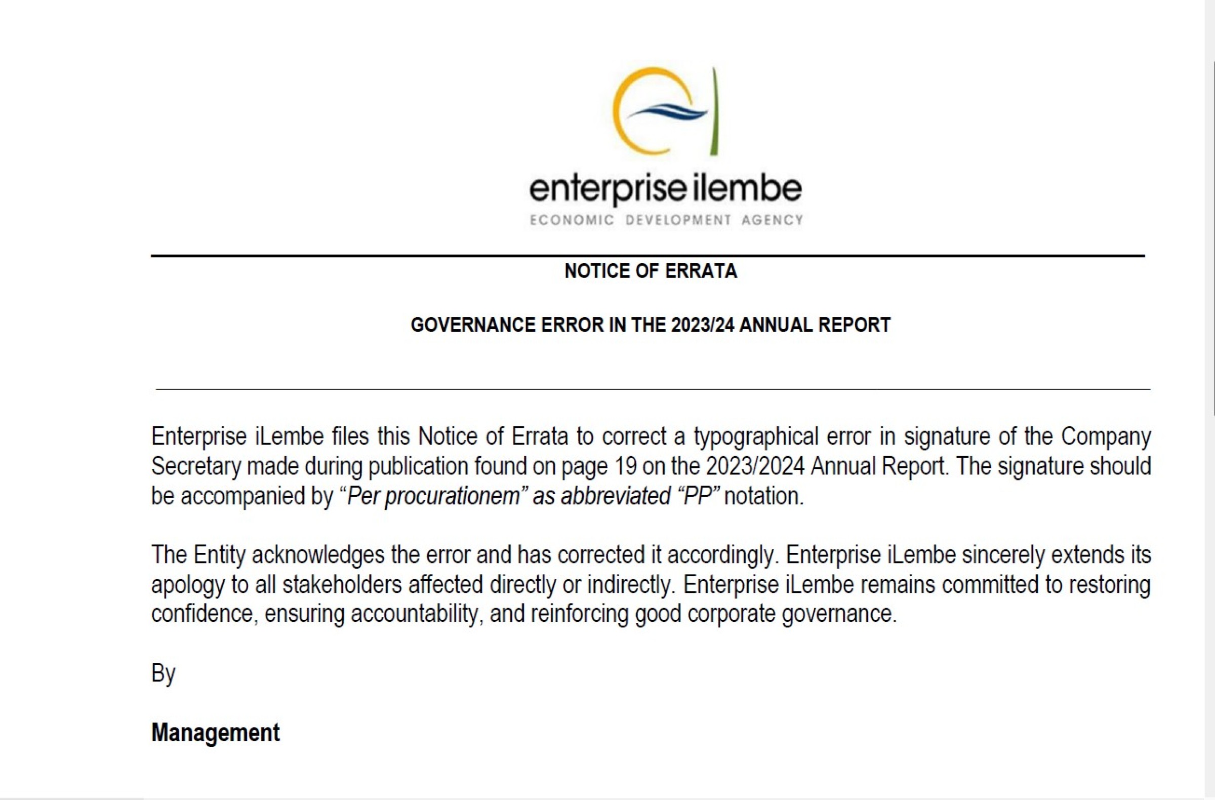
View TendersAccess annual reports, strategic plans and performance publications for accountability and planning.
Browse ReportsFollow public notices, programme highlights and district economic development updates.
Read News